Tuesday, December 27, 2016

The Real NYC #39 - Kiku: The Art of Japanese Gardening at the NYBG


Kiku Butterfly


 The chrysanthemum is the flower of fall. And what a flower it is. It comes in so many colors and so many varieties. And no part of the world has become as synonymous with growing chrysanthemums as Japan. In Japanese, these beautiful flowers are called kiku and the Japanese have made an art out of training them, much the same way that they train trees in bonsai.

This past October, the New York Botanical Gardens staged an excellent show – Kiku: The Art of the Japanese Garden.  Featuring thousands of chrysanthemums, this exhibit showed all of the skills used to showcase the colors and shapes of these mums. 


I have lived in NYC all of my life, but it is only in the past couple of years that I have really appreciated the Botanical Gardens. I have grown to appreciate the NYBG, not for the gardens, which I enjoy, but for the shows. Every year they tie together art and botany in a way that is both beautiful and educational. I cannot wait to see what they have in store for the spring.

Tuesday, December 20, 2016

Celebrate Kentucky History in Danville


Governor's Circle

Danville is a small town in the center of Kentucky with a large history. It played an important role in the development of Kentucky as a state and, along with nearby Perryville, an important role in the keeping Kentucky in the Union during the Civil War.

Danville Kentucky


Danville is an old town by Kentucky standards. It dates back to the 1770’s making it one of the first European settled towns in the territory. It was first settled in 1774 by John Crow, and became an actual town when Walker Daniel bought 76 acres and designed the town grid in 1783. At that time this area was part of the state of Virginia. Danville hosted several conventions leading up to Kentucky gaining independence and becoming a state. In 1788 Virginia gave its permission for Kentucky to become independent and in 1792 Kentucky became the fifteenth state, and Danville was its first capital.
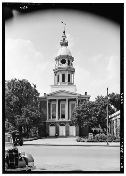
File:Historic American Buildings Survey Lester Jones, Photographer May 30, 1940 SOUTH ELEVATION - Boyle County Courthouse, Danville, Boyle County, KY HABS KY,11-DANV,7-1.tif
Boyle County Courthouse 1940 -  See page for author [Public domain], via Wikimedia Commons


Danville’s history is present for all to see in Constitution Square, a park in the center of town that has become home to replicas of many important buildings from Danville’s history. The one original building left is the Post Office. The also includes replicas of the original jail, the Presbyterian Meeting House and Greyson’s Tavern. The entrance at the northwest corner passes by the Governor’s Circle which is built around a statue of two men taken from the state seal and flag. There is a plaque commemorating each of Kentucky’s governors. Nearby are two historical markers dedicated to the role of African Americans in fighting for the Union forces during the Civil War. 

Danville Jailand courthouse


Grayson's Tavern

Boyle County Courthouse 2015


Danville has been home to several colleges since it was first formed. Transylvania University was founded there in 1783 before moving to Lexington. Today it is home to Centre College a small liberal arts college. Four other universities and colleges have satellite campuses in Danville.

We also found two very good restaurants. One was Jane Barleycorn’s Market and Bar. The food was fresh and locally sourced. We had a wonderful dinner there. For breakfast we went to The Hub Coffee House and Café. Excellent coffee and breakfast wraps.

Perryville Battlefield – Perryville KY


Ten miles from Danville is the site of the Perryville Battlefield. Perryville was an important battle during the Civil War. Like Maryland, Kentucky was a slave state that did not leave the United States in 1861. In the fall of 1862 the Confederate Army made an attempt to tear the border slave states away from the Union. I have always loved walking around battlefields. It is often hard to understand battle tactics, but walking around you get a very good feel for what happened. It helps that the state of Kentucky has put together a very good walking trail (of about 2 miles) that covers the main parts of the battle, and over 20 miles of walking and driving trails in total. The trail have been set up with places to stop that include very good explanations and battle maps.
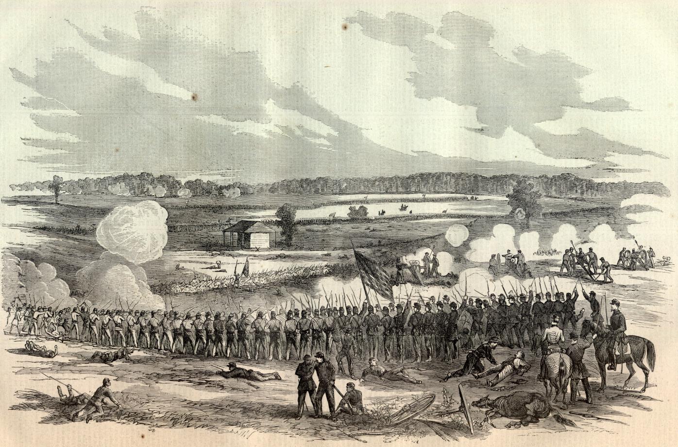

See page for author [Public domain], via Wikimedia Commons

What really struck me is that as I was walking around the site, it was easy follow why the Confederate Army might have had what some people call a tactical victory, but still lost the day.  The main forces were The Army of Ohio under General Don Carlos Buell against The Army of Mississippi under General Braxton Bragg. As the two armies faced off, the Army of Mississippi took the offensive and attacked the lines of the Ohioans. But the General Buell’s forces had greater numbers and they had set up a series of defensive lines along a sequence of hill tops. This meant that as General Bragg’s troops advanced, they were forced to constantly fight literally up-hill battles, leaving casualties strewn across the battlefield.  By the end of the day, even though they had “won” many of the skirmishes, they were in no condition to continue, especially as the Union forces were being reinforced. Bragg was forced to retreat to Danville, and back through the Cumberland Gap.

Union Memorial at Perryville Battlefield Site


Walking through the fields and hills of battle site, you can see why the battle turned out the way it did. The rolling hills were steep enough to give serious advantage to whomever could control the top of the hill, and that was always the Union Army. Now, I am no historian, but I believe that this win for the Union Army was well planned and thought out. They knew that the Confederates had to be on the offense, so they created a series of defensive lines that allowed them to force the Confederates to constantly fight from inferior and more dangerous positions.

Looking uphill at a Union Army position
View from the top of the hill, note the fence where many confederate troops were stopped

Fence line along the road


The Battle of Perryville, along with the Battle of Antietam, played a key role in the Civil War. The first two years had been mostly wins for the Confederacy. President Lincoln was looking for an appropriate time to announce the Emancipation Proclamation, and these two Union victories, less than a month apart, gave Lincoln that opportunity. 

http://www.civilwar.org/education/history/emancipation-150/eman-proc-doc.jpg
 
I would love to come back to Kentucky. There is the whole Bourbon industry that I would love to explore. But if I do, I plan and passing through this part of Kentucky again.

Getting There: Danville sits at the junction of U.S. 150 which comes southeast from Louisville and U.S. 27 which come south from Lexington.

Tuesday, December 13, 2016

Walking across the Ohio River on the Big Four Railraod Bridge in Louisville KY


The Big Four Bridge


Have I ever mentioned that I LOVE machinery? I mean it I love machinery, the bigger the better. Trucks, trains, building equipment, and all of the things that go with them. On a recent trip to Louisville I found out there is an old railroad bridge that had been turned into a pedestrian walkway across the Ohio River between Kentucky and Indiana. Well, I just had to visit The Big Four Railroad Bridge, and it was grand.
 

The Big Four Railroad Bridge was originally built in 1895 between Louisville, KY and Jeffersonville IN. It is a truss bridge that spans over 2500 ft. (770m). It is named after the Cleveland, Cincinnati, Chicago and St. Louis Railway, which was nicknamed The Big Four Railway. The Big Four Bridge was in use until 1969 when the Penn Central Railroad rerouted all of its traffic over the nearby Fourteenth Street Bridge. Shortly after, both the Kentucky and Indiana approaches were taken down and sold for scrap, leaving a bridge that literally went nowhere.

The Big Four Bridge (1975) - Jack Boucher [Public domain], via Wikimedia Commons

In 2011 the governors of Indiana and Kentucky agreed to build pedestrian ramps and create a walkway between the states, and both sides were opened by 2014.

And what a walkway this is. The Kentucky side starts at The Waterfront Park with a long spiral ramp up to the bridge, a climb of about 50 vertical feet (about 5 stories). Walking up the ramp you get wonderful views of the bridge from both the east and west sides, as it circles around for ¼ mile. The ramp is a wonderful introduction to the bridge, tying the brand new park to this historic structure, it brings you up from ground and gives you time to appreciate beautiful architecture of the bridge before you cross it.

Waterfront Park ramp to bridge


The Big Four Bridge itself is a phenomenal example of a classic truss bridge. The riveted steel beams travel vertically and at angles, making balancing the forces of the trains that crossed it. It is comprised of 6 individual spans, the longest of which is 547 feet long. But this is not the original bridge. The Big Four was completely rebuilt in 1929 using an unusual technique. The new bridge was built inside the framework of the old one. This saved time during the construction and allowed the replacement to take less than a year. This method meant that the new bridge was smaller than the original, and could only accommodate one track, instead of the two that it had before. That track is represented today brown stripes of cement down the center of the walkway.


Walking across the Big Four Bridge is a wonderful experience. The Ohio River is one of the biggest in the country, in fact it is almost half a mile wide at this point. It is also a working river, and if you are lucky you might get to see some barges passing by. Just to the north of the bridge is Towhead Island, where barges are tied up waiting to be transferred up or down the river. 

Barges on Towhead Island


Barges going down the Ohio


The walk across the Big Four Bridge is about one mile long, and if you do it right it should take close to an hour. This is because you really should stop and take in the sights. As you walk across you get some wonderful views of downtown Louisville and the three other bridges that cross the Ohio – The I-65 Bridge, The Clark Memorial Bridge and the 14th Street Train Bridge. Stop and look at how the shadow of the bridge changes as Sun moves across the sky. There are benches where you can sit and look out at the river traffic, or if you turn around, you can watch the people walking by. There are displays along the path giving information about the history and structure of the bridge. But really, the bridge is a place to slow down and take in both natural and man made beauty. It is a place to meditate on life.


The Amazing Ms. D enjoying the view in Waterfront Park


When you visit Louisville make sure to get over to Waterfront Park and take a walk across the Ohio on the Big Four Railroad Bridge. It is a wonderful way to spend an afternoon.